Don’t run Euchre Bar Massacre. It could easily kill you. That said, if Sean organizes it again next year, I’ll be back in a heartbeat.
This year I was one of three hearty fools to show up for the fifty mile division, while about a dozen runners made it out for the twenty-five. I arrived for the pre-dawn start in Alta, CA at the last possible moment, and missed most of the pre-race briefing. I’d made it home from work the night before later than planned, finished packing later still, and showed up at our group campsite nearby to sleep poorly in my car later than I would have liked, so while I was excited to get down into the canyon and start our adventure I was a little on the groggy side. It sounded like the briefing contained little key information that wasn’t also in the maps and direction packets we’d been sent a couple days ago, but I’d just have to hope that was true.
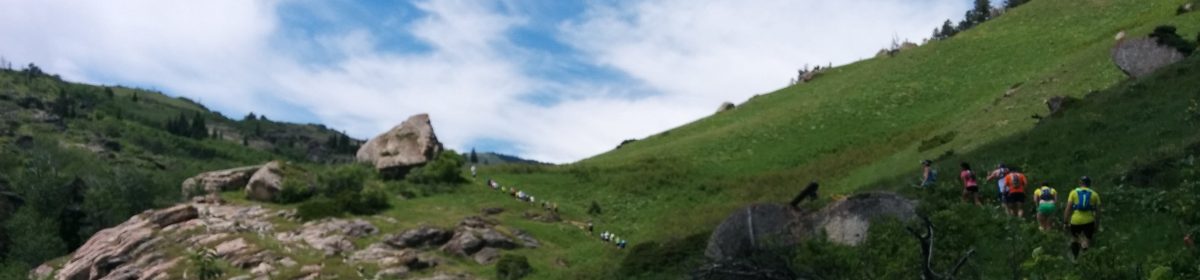
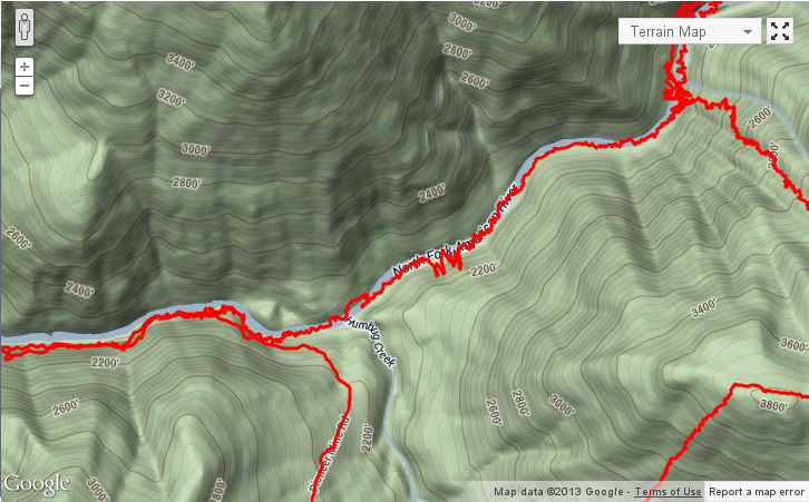
The first two miles were a steep downhill on the wide, groomed Euchre Bar Trail[1], which was fun, easy running for me, and for the first time in any race I had to force myself not to pass the leaders. This bottomed out 1800 feet below at a footbridge across the North Fork American River where some runners stashed a bit of their gear and food for the return trip, and the trail then veered east above the banks of the river itself.
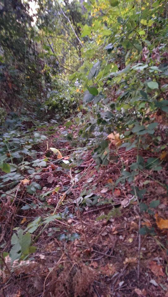
After a couple of miles of rolling trail along the river, things would start to get interesting. After a short segment along a dirt road, the first climb would take us up the switchbacks of an unmaintained trail that at a few points was fully overgrown with blackberry vines. Judging by the scat in the neighborhood, bears had already taken care of the berries, but they didn’t take out nearly so many of the thorns for me.
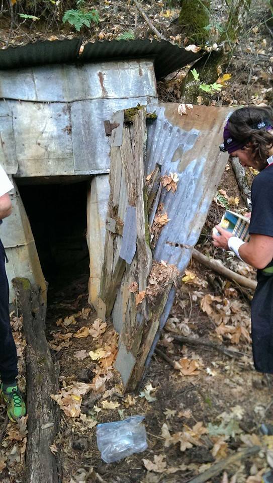
About two-thirds of the way up, another group of runners caught up with me. They started to overtake me just as we reached the turn-off for Pioneer Mine, where we found our first book. In the tradition of the Barkley Marathons, each runner would tear out a page corresponding to their race number to prove they’d been their. Our inaugural book was the Kurt Vonnegut classic Breakfast of Champions. While part of me felt bad about mangling any book, let alone one I’d loved when I read it back in high school, I can’t deny that another part of me was just sad I didn’t end up with the famous asshole page.
From there, the instructions told us to keep switchbacking up the hill, vines or no vines. I followed the instructions a bit too literally when I angled into a sort of slanted T-intersection, and turned sharp right instead of continuing almost straight to the left fork. If I’d walked another few steps before making my decision I would have noticed a stick arrow laid out on the ground pointing the way. Fortunately, my trail disappeared after less than half a mile, but I lost a few more minutes making sure I hadn’t somehow walked off the main trail and lost sight of it.
Back on course, I was treated with my second fast downhill. As it turned out, this would be my last chance to make up any real time, and it wouldn’t be enough.
At the bottom of this jeep road, the trail followed a creek which fed into the American River. At the end of this trail I found book number two, Coast Road. From here the instructions said to tear out a page, fill up on water, cross the stream, and begin making my way up Ebeneezer’s Highway:
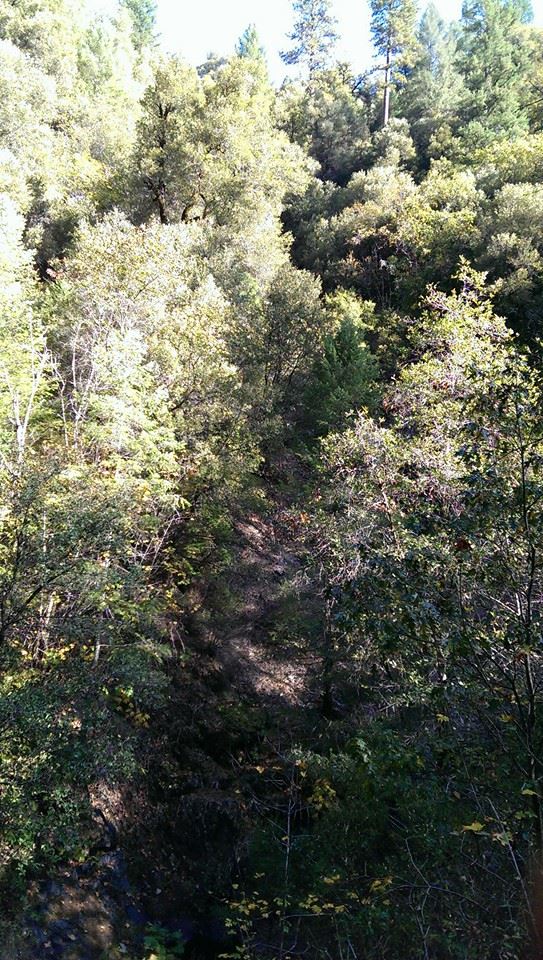
“Scramble up the bank on the other side of the river and continue up the hill by the steepest route possible for 1500 vertical feet. Go straight up, if you angle to your left you will go around the top and cause yourself extra distance, and if you go to the right you will head up the canyon and have extra climbing. There are a few trails you will cross, ignore them and keep going straight up through the manzanita stands until you get to the clearing at the top of the climb.”
Easier than it sounds.
The first few hundred feet were at a grade of over 50%, and covered in new pine mulch and chipped slate. The surface improved to dead leaves and loose soil, but the grade did not change significantly for the first 800 vertical feet. At one point I made the mistake of veering off to the left for only a few feet, and found myself rock climbing a short ways instead. My hiking poles were often useful here, as I could jam them deep into the top soil, but sometimes I was better off scrambling with all four limbs.
Just as the climb started to soften a few degrees, I heard other “runners” nearby off to my right. I reached a level trail intersecting my path in the middle of a manzanita grove, and followed it over to find Mark, the director of the almost equally absurd Me-Ow Marathons, and his daughter Lorelei resting up mid-climb. They were surprised to see me and not another runner, Kirk, who had been with them for much of the race so far. Lorelei said she planned to drop when she reached the 25-mile turn around point at the top of this climb. She was acrophobic, and didn’t want to descend Ebeneezer’s. I couldn’t blame her. I was a little worried about descending it in the dark myself, something that seemed certain at the rate I was going.
The two of them continued along the trail to look for a way up that skirted the dense manzanita grove, while I decided to stick closely to the instructions. The climbing wasn’t quite as bad for the second half of the 1500 vertical feet, but it was still steep, and I often found myself crawling under manzanita branches that tore at the fabric of my pack, if not my skin.
When I knew I had to be nearing the top, I heard voices through the brush, and figured I must be reconverging with Mark and Lorelei again, but it turned out to be Ginny and Eric on their way back down from the turn around. They had bad news for me: I was already twenty minutes past the first cut-off, and had a good ways to go. They estimated it had taken them about an hour just to get back down to where we were from the turn-around checkpoint, and at the rate I was going uphill I knew that meant more than an hour for me. I figured that even if Sean wanted to be flexible, I’d drop down to the twenty-five mile course: I probably wouldn’t have the energy to push on steadily enough to meet the later cut-offs for the fifty regardless.
Finally, the scrambling of Ebeneezer’s Highway topped out at Humbug Ridge. There was another 1500 feet to climb, but it was so gradual they were even able to build a fire road on it. And then fill that fire road with deadfall, forcing me to hike through the woods off to the side, but this was still a welcome relief. By the time things truly leveled out, I had climbed far enough that I could feel a difference in the oxygen level for the first few minutes.
Approaching the flatter Italian Bar road spur, I looked up from the trail to see a massive pile of bulldozed deadwood. As I continued along the trail around the pile, I heard two gunshots, far closer than I ever want to hear gunfire without knowing its source and direction. I called out immediately. A moment later a man walked over from behind the pile. “Are there any more runners coming behind you?” he asked. I told him I had no idea and kept going up the road. A moment later, the gunshots started up again behind me.
Just around the corner from the turn-around, I bumped into Mark coming back the other way. Apparently his route had worked out well. He told me Sean, the organizer, had run off to chase down Kirk, who had missed the last turn on this dirt road for the turn-around.
At fifteen miles in, a collection of drop bags and camp chairs in a remote parking lot was a sight for sore eyes. Lorelei was already there, and Sean and Kirk showed up soon after I started refilling my pack. As I’d predicted, Sean offered to let me continue, but I opted instead to make the return trip with Kirk, even though he told me he’d be a bit slower with some foot issues. I’d already missed out on meeting my original goal for the day, and I was fine with having a good adventure and training run out of it.
On our way back down Humbug Ridge, we started chatting, and I should have paid more attention to what Kirk had to say about how the morning went for him. Running past the turn-around hadn’t been his only navigational error. When we started to approach the section where we’d need to drop down and descend Ebeneezer’s, he suggested we begin our descent early and angle off to the right, cutting a more gradual line down the hillside. I hesitated, but not enough, before deciding it was worth a try, since after all I just wanted a good adventure and good training out of it. Worst of all, I failed to check my map and my compass to see that rather than cutting across and hopefully rejoining the line we’d taken up the cliff, we were dropping off another side of the hill altogether.
The descent wasn’t easy, but it was far too easy compared to the trip up. That should’ve been our first clue. Our second clue should’ve been that we didn’t encounter any manzanita. Finally, you’d really think we would have noticed that it was too wide and flowing a bit too much in the wrong direction to be the creek we’d crossed before. You’d think.

Instead, we continued under the assumption that we had arrived back at Humbug Creek, and somewhere above the other bank if maybe a bit off to our right we’d find the trail we took to get there, or the jeep road we took to get to that trail. So we made our way upstream until we found a spot to cross and attempt to climb up to a road that wouldn’t be there, up a steep bank and overgrown bank, scrambling again at times, or carefully navigating over loose rock, looking for game trails that would take us in what we thought would be the right direction. It took about forty-five minutes of this for me to finally behave like a sane person, pull out my map and compass, and figure out that we were going in the wrong direction altogether. We must have somehow crossed the river, not the stream, and there was nothing but more hillside along this vector as far as ink met page. We decided to focus instead on getting back down to the river from where we were before the sun finished setting and try to work out a better plan from there.
At one point as we were climbing near a rocky outcropping, something gave way under Kirk who was uphill from me, and I heard him land hard. I called out to ask if he was okay when the dust had literally settled. He replied that he didn’t think anything was broken, maybe a little sprained. Now the situation was starting to worry me, but there was nothing to do but press on.
Back at the river, we decided to continue downstream as close to the water as possible. Before long we expected to find the mouth of the creek we’d meant to cross originally, and from there it would be easy to get back on course. Unfortunately, staying on the riverbanks proved more difficult than we hoped. The October flow was low and gentle, exposing many of the sandbars, but the banks themselves often turned into jumbles of boulders or smoothly carved granite. When we couldn’t boulder-hop, we crossed to the other side, waded down the middle of the river, or scrambled back up the cliff for a ways, again searching for game trails, dodging loose rocks, and sometimes enjoying the distinct pleasure of clinging to blackberry and poison oak vines for dear life.
Of course, our difficulties didn’t end their. On top of compounding minor injuries, Kirk’s headlamp was not up to the task. It’s good that he had one, but his lightweight cap-mounted model was better suited to neighborhood jogs than wilderness pathfinding. When I suggested we ford a deeper section of the river, I learned that he couldn’t swim, which at last explained his discomfort with many of the crossings I’d found easy. At times I worried he was on the verge of panic, and to be honest it was hard to blame him, but when he was moving he was moving well, so I tried to make sure to keep us moving. We both tried to keep the jokes going, at least most of the time.
Now that we had a plan, the “breadcrumb” map display on my GPS watch, which can be unfortunately confusing on its own, seemed to be showing us that we should hit the mouth of the creek any time now. Within half a mile. Within a quarter mile. Maybe a tenth of a mile, it’s too close to be sure. Okay, maybe I was wrong about that, but it must be around here somewhere…
Eventually I realized we must have somehow missed Humbug Creek. Looking at the downloaded data afterwards, I would see that we did a remarkable job of climbing up above the opposite bank for just long enough to stand no chance of seeing it at night, but it may have deposited enough debris in the river to help us make that decision. Once I’d come to this conclusion, I spent about a minute comparing map, compass, and watch while Kirk was catching up behind me, then started taking off up the hill instead of following the river. Not two minutes later, after I was back on the Euchre Bar Trail, two miles from the footbridge.
As good as it felt to reach my drop bag at the fifteen mile point, it felt even better to reach the gear Kirk had stashed at the bridge. I asked him if he was sure he didn’t want to head up Nun’s Finger for book number three, a climb even steeper than Ebeneezer’s Highway. He was sure.
That last 1800 foot climb back out of the canyon might not have been fast, but after travelling five miles in as many ours in, on, and above the North Fork American River, it felt pretty good to me. A few feet from the top we saw a couple lights coming down the hill toward us and called out. It turned out to be Ginny and Eric, who’d been waiting up at the trailhead, in contact with Sean. They had intermittent reception, and they’d be able to let him know we were both OK.
Although we’ve both talked about coming back next year, so maybe “OK” is just the slightest overstatement.
Don’t run Euchre Bar Massacre. You’ve surely got too much to live for. Otherwise, I’ll see you there.
great report!
Wow. I’ve known for a while that you are not normal and are way more willing (and capable) than I to do wildly non-standard events. But still – yikes! The “asshole” page would have really made this event though.
Ha! I’m not sure if that’s a compliment, but I’ll take it!
Great writeup, interesting to hear the details of everybody’s adventure. What’s the asshole page? I’ve never heard that one before.
Thanks for reminding me. I meant to link to it in the post: http://fuuka.warosu.org/data/lit/img/0028/79/1344352914573.jpg
At the time, it seemed that missing the manzanita was a good thing. Next year I’ll have a better light and bring the compass. I still don’t think I want to handle Nun’s in the dark, so I’ll probably stick to the 25. On the other hand, I wouldn’t have even thought of this a year ago so who knows what I’ll be thinking next year. Thanks for getting us going the right direction.
Damn, I was signed up for this and totally looking forward to it, but got my ass severely handed to me at Mogollon Monster two weeks prior and just couldn’t get back on my feet in time. I’m surprised so few people started though; it was totally booked up with a waiting list!
Looks like it was everything I was hoping: almost impossible. Here’s to hoping it’s on for next year!